 |
|
|
|
|
|
 |
 |
 |
 |
|
|
| Click on view to enlarge. |
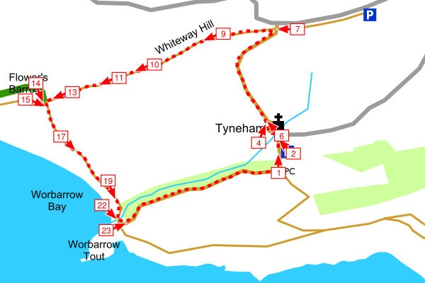
Flower's Barrow, Tyneham - Range Walks, Dorset |
|
|
Start the walk by walking through Tyneham village via the church and the school house, then follow the track up the hill to the road. Continue along the top of Whiteway Hill to Flower's Barrow. From Flower's Barrow follow the coast path down a steep hill then turn inland along the track back to Tyneham Village.
See the detailed walk directions. Alternatively download the picture guide [help] for this walk.
Flower's Barrow is the remains of an Iron Age Hill (about 300 BC) Fort one side of which has fallen into the sea due to coastal erosion.
Please check our walk preparation guide.
|
|
|
|
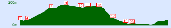
| Distance: | 3.5 miles / 5.6 km | Date: | Aug 2010 |
| Climb: | 720 feet / 219 m |
Walk Duration: | 1 hr 55 mins |
| Difficulty: | Moderate | Calories used: | 540 kcals |
|  |
|
|
The arrows on the map show the locations of walk direction pictures.
|